Species Report
White-eyed Vireo
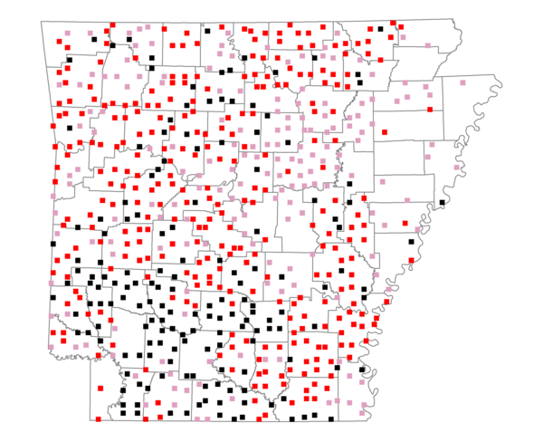
Total number of 2,500 hectare plots where this species is found: 644 ( 73.6% of plots )
| CATEGORY | Hectares, 1994 | % of Total, 1994 | Hectares, 1999 | % of Total, 1999 | Hectares, 2004 | % of Total, 2004 |
| Forest - Total (All Categories) | 1087564.6 | 60.95 | 1102459.4 | 68.46 | 1087063.5 | 67.50 |
| Ozark-Ouachita Pine-Oak Forest | 323697.0 | 18.14 | 285398.8 | 17.72 | 280732.5 | 17.43 |
| Ozark-Ouachita Dry Oak Woodland and Forest | 45465.2 | 2.55 | 36204.1 | 2.25 | 35664.4 | 2.21 |
| Central Interior Highlands Glade and Barrens | 43058.7 | 2.41 | 35240.0 | 2.19 | 34843.6 | 2.16 |
| Mesic Hardwood Forest | 2237.3 | 0.13 | 1969.4 | 0.12 | 1962.9 | 0.12 |
| Dry-Mesic Oak Forest | 241821.7 | 13.55 | 203572.8 | 12.64 | 199344.7 | 12.38 |
| West Gulf Coastal Plain Pine-Hardwood Forest | 207538.7 | 11.63 | 180017.2 | 11.18 | 168596.6 | 10.47 |
| West Gulf Coastal Plain Small Stream Forest | 1022.7 | 0.06 | 659.5 | 0.04 | 697.9 | 0.04 |
| Lower Mississippi River Low Bottomland Forest | 43674.5 | 2.45 | 34868.9 | 2.17 | 34305.7 | 2.13 |
| Lower Mississippi River High Bottomland Forest | 163766.5 | 9.18 | 138992.7 | 8.63 | 136371.9 | 8.47 |
| Lower Mississippi River Bottomland Depression | 7921.6 | 0.44 | 6597.7 | 0.41 | 6382.2 | 0.40 |
| Lower Mississippi River Riparian Forest | 1554.5 | 0.09 | 556.7 | 0.03 | 605.7 | 0.04 |
| Sweetgum | 5806.1 | 0.33 | 4832.8 | 0.30 | 4668.2 | 0.29 |
| Forest - Unknown Category | 0.0 | 0.00 | 173548.8 | 10.78 | 182887.3 | 11.36 |
| Cropland | 238673.9 | 13.38 | 161686.9 | 10.04 | 159047.6 | 9.88 |
| Pastureland | 368164.6 | 20.63 | 252583.4 | 15.68 | 241797.4 | 15.02 |
| Herbaceous | 1803.6 | 0.10 | 16159.7 | 1.00 | 24589.0 | 1.53 |
| Bare/Barren | 1278.2 | 0.07 | 816.3 | 0.05 | 1349.1 | 0.08 |
| Urban | 8148.2 | 0.46 | 12894.4 | 0.80 | 34589.8 | 2.15 |
| Water | 55563.6 | 3.11 | 43121.7 | 2.68 | 41219.1 | 2.56 |
| Unknown (No Data) | 23054.3 | 1.29 | 20635.7 | 1.28 | 20702.1 | 1.29 |