Species Report
Snowy Egret
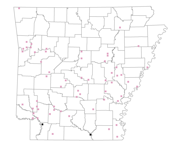
Total number of 2,500 hectare plots where this species is found: 60 ( 6.9% of plots )
| CATEGORY | Hectares, 1994 | % of Total, 1994 | Hectares, 1999 | % of Total, 1999 | Hectares, 2004 | % of Total, 2004 |
| Forest - Total (All Categories) | 69092.1 | 41.55 | 75211.2 | 50.12 | 79089.4 | 52.71 |
| Ozark-Ouachita Pine-Oak Forest | 11994.1 | 7.21 | 10343.3 | 6.89 | 9999.3 | 6.66 |
| Ozark-Ouachita Dry Oak Woodland and Forest | 534.6 | 0.32 | 452.5 | 0.30 | 456.1 | 0.30 |
| Central Interior Highlands Glade and Barrens | 163.4 | 0.10 | 138.2 | 0.09 | 135.6 | 0.09 |
| Mesic Hardwood Forest | 8.0 | 0.00 | 7.2 | 0.00 | 7.2 | 0.00 |
| Dry-Mesic Oak Forest | 7691.6 | 4.63 | 6189.9 | 4.13 | 6061.7 | 4.04 |
| West Gulf Coastal Plain Pine-Hardwood Forest | 13532.9 | 8.14 | 11539.2 | 7.69 | 11270.6 | 7.51 |
| West Gulf Coastal Plain Small Stream Forest | 364.6 | 0.22 | 94.0 | 0.06 | 110.1 | 0.07 |
| Lower Mississippi River Low Bottomland Forest | 6589.1 | 3.96 | 5089.2 | 3.39 | 5074.4 | 3.38 |
| Lower Mississippi River High Bottomland Forest | 25430.8 | 15.29 | 21013.5 | 14.00 | 20777.0 | 13.85 |
| Lower Mississippi River Bottomland Depression | 1900.5 | 1.14 | 1576.7 | 1.05 | 1589.1 | 1.06 |
| Lower Mississippi River Riparian Forest | 302.0 | 0.18 | 163.6 | 0.11 | 174.2 | 0.12 |
| Sweetgum | 580.7 | 0.35 | 487.4 | 0.32 | 481.8 | 0.32 |
| Forest - Unknown Category | 0.0 | 0.00 | 18116.5 | 12.07 | 22952.3 | 15.30 |
| Cropland | 46251.6 | 27.81 | 29414.1 | 19.60 | 27133.6 | 18.08 |
| Pastureland | 35309.5 | 21.23 | 30715.8 | 20.47 | 26578.2 | 17.71 |
| Herbaceous | 516.6 | 0.31 | 2748.3 | 1.83 | 2781.1 | 1.85 |
| Bare/Barren | 294.8 | 0.18 | 64.1 | 0.04 | 191.4 | 0.13 |
| Urban | 859.3 | 0.52 | 2295.8 | 1.53 | 5685.5 | 3.79 |
| Water | 13775.0 | 8.28 | 9466.5 | 6.31 | 8456.6 | 5.64 |
| Unknown (No Data) | 192.4 | 0.12 | 132.0 | 0.09 | 132.0 | 0.09 |