Species Report
Scarlet Tanager
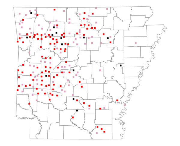
Total number of 2,500 hectare plots where this species is found: 193 ( 22.1% of plots )
| CATEGORY | Hectares, 1994 | % of Total, 1994 | Hectares, 1999 | % of Total, 1999 | Hectares, 2004 | % of Total, 2004 |
| Forest - Total (All Categories) | 390845.5 | 73.08 | 394169.7 | 81.67 | 391132.6 | 81.05 |
| Ozark-Ouachita Pine-Oak Forest | 209655.9 | 39.20 | 186479.4 | 38.64 | 184417.4 | 38.21 |
| Ozark-Ouachita Dry Oak Woodland and Forest | 15120.3 | 2.83 | 12134.4 | 2.51 | 11878.3 | 2.46 |
| Central Interior Highlands Glade and Barrens | 13947.2 | 2.61 | 11413.7 | 2.37 | 11280.3 | 2.34 |
| Mesic Hardwood Forest | 2027.6 | 0.38 | 1780.2 | 0.37 | 1772.8 | 0.37 |
| Dry-Mesic Oak Forest | 103596.8 | 19.37 | 89671.8 | 18.58 | 88964.8 | 18.43 |
| West Gulf Coastal Plain Pine-Hardwood Forest | 26579.6 | 4.97 | 23048.3 | 4.78 | 21164.8 | 4.39 |
| West Gulf Coastal Plain Small Stream Forest | 198.9 | 0.04 | 168.3 | 0.03 | 162.8 | 0.03 |
| Lower Mississippi River Low Bottomland Forest | 2282.2 | 0.43 | 1789.0 | 0.37 | 1739.3 | 0.36 |
| Lower Mississippi River High Bottomland Forest | 14766.2 | 2.76 | 12445.9 | 2.58 | 12209.8 | 2.53 |
| Lower Mississippi River Bottomland Depression | 547.2 | 0.10 | 474.3 | 0.10 | 447.8 | 0.09 |
| Lower Mississippi River Riparian Forest | 167.8 | 0.03 | 124.8 | 0.03 | 125.3 | 0.03 |
| Sweetgum | 1955.8 | 0.37 | 1695.0 | 0.35 | 1680.2 | 0.35 |
| Forest - Unknown Category | 0.0 | 0.00 | 52944.4 | 10.97 | 55289.0 | 11.46 |
| Cropland | 18350.9 | 3.43 | 7508.3 | 1.56 | 7506.2 | 1.56 |
| Pastureland | 109405.3 | 20.46 | 65682.8 | 13.61 | 62420.9 | 12.93 |
| Herbaceous | 244.4 | 0.05 | 1757.9 | 0.36 | 3397.6 | 0.70 |
| Bare/Barren | 35.9 | 0.01 | 33.5 | 0.01 | 124.8 | 0.03 |
| Urban | 889.7 | 0.17 | 1085.2 | 0.22 | 6029.3 | 1.25 |
| Water | 11734.6 | 2.19 | 9447.1 | 1.96 | 9059.7 | 1.88 |
| Unknown (No Data) | 3277.5 | 0.61 | 2925.2 | 0.61 | 2938.6 | 0.61 |