Species Report
Red Crossbill
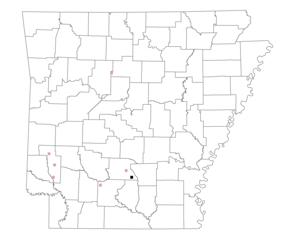
Total number of 2,500 hectare plots where this species is found: 7 ( 0.8% of plots )
| CATEGORY | Hectares, 1994 | % of Total, 1994 | Hectares, 1999 | % of Total, 1999 | Hectares, 2004 | % of Total, 2004 |
| Forest - Total (All Categories) | 15627.6 | 80.60 | 15546.7 | 88.70 | 15059.8 | 85.93 |
| Ozark-Ouachita Pine-Oak Forest | 4070.1 | 20.99 | 3666.0 | 20.92 | 3623.4 | 20.67 |
| Ozark-Ouachita Dry Oak Woodland and Forest | 0.0 | 0.00 | 0.0 | 0.00 | 0.0 | 0.00 |
| Central Interior Highlands Glade and Barrens | 0.0 | 0.00 | 0.0 | 0.00 | 0.0 | 0.00 |
| Mesic Hardwood Forest | 175.5 | 0.91 | 157.5 | 0.90 | 157.5 | 0.90 |
| Dry-Mesic Oak Forest | 2396.6 | 12.36 | 2108.1 | 12.03 | 2033.6 | 11.60 |
| West Gulf Coastal Plain Pine-Hardwood Forest | 6847.8 | 35.32 | 5950.3 | 33.95 | 5585.8 | 31.87 |
| West Gulf Coastal Plain Small Stream Forest | 0.0 | 0.00 | 0.0 | 0.00 | 0.0 | 0.00 |
| Lower Mississippi River Low Bottomland Forest | 86.9 | 0.45 | 77.9 | 0.44 | 66.6 | 0.38 |
| Lower Mississippi River High Bottomland Forest | 1836.6 | 9.47 | 1580.8 | 9.02 | 1563.5 | 8.92 |
| Lower Mississippi River Bottomland Depression | 214.1 | 1.10 | 187.3 | 1.07 | 177.0 | 1.01 |
| Lower Mississippi River Riparian Forest | 0.0 | 0.00 | 0.0 | 0.00 | 0.0 | 0.00 |
| Sweetgum | 0.0 | 0.00 | 0.0 | 0.00 | 0.0 | 0.00 |
| Forest - Unknown Category | 0.0 | 0.00 | 1818.8 | 10.38 | 1852.4 | 10.57 |
| Cropland | 0.0 | 0.00 | 0.0 | 0.00 | 9.4 | 0.05 |
| Pastureland | 3581.0 | 18.47 | 1629.7 | 9.30 | 1731.1 | 9.88 |
| Herbaceous | 28.3 | 0.15 | 215.2 | 1.23 | 317.6 | 1.81 |
| Bare/Barren | 0.0 | 0.00 | 0.0 | 0.00 | 0.0 | 0.00 |
| Urban | 3.1 | 0.02 | 31.6 | 0.18 | 280.8 | 1.60 |
| Water | 148.7 | 0.77 | 103.2 | 0.59 | 127.8 | 0.73 |
| Unknown (No Data) | 0.0 | 0.00 | 0.0 | 0.00 | 0.0 | 0.00 |