Species Report
Red-cockaded Woodpecker
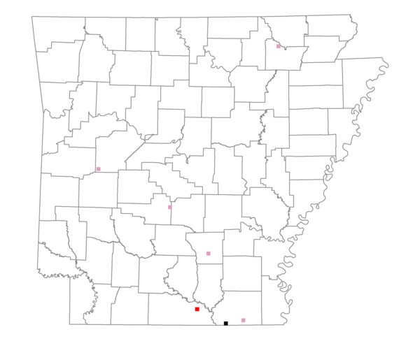
Total number of 2,500 hectare plots where this species is found: 7 ( 0.8% of plots )
| CATEGORY | Hectares, 1994 | % of Total, 1994 | Hectares, 1999 | % of Total, 1999 | Hectares, 2004 | % of Total, 2004 |
| Forest - Total (All Categories) | 16544.7 | 85.19 | 16014.7 | 91.75 | 15204.0 | 87.10 |
| Ozark-Ouachita Pine-Oak Forest | 3099.6 | 15.96 | 2772.9 | 15.89 | 2698.6 | 15.46 |
| Ozark-Ouachita Dry Oak Woodland and Forest | 427.1 | 2.20 | 361.0 | 2.07 | 353.5 | 2.03 |
| Central Interior Highlands Glade and Barrens | 380.1 | 1.96 | 313.9 | 1.80 | 299.8 | 1.72 |
| Mesic Hardwood Forest | 0.0 | 0.00 | 0.0 | 0.00 | 0.0 | 0.00 |
| Dry-Mesic Oak Forest | 1796.5 | 9.25 | 1517.8 | 8.70 | 1477.7 | 8.47 |
| West Gulf Coastal Plain Pine-Hardwood Forest | 8051.0 | 41.46 | 7052.3 | 40.40 | 6457.3 | 36.99 |
| West Gulf Coastal Plain Small Stream Forest | 0.0 | 0.00 | 0.0 | 0.00 | 0.0 | 0.00 |
| Lower Mississippi River Low Bottomland Forest | 487.5 | 2.51 | 417.3 | 2.39 | 408.7 | 2.34 |
| Lower Mississippi River High Bottomland Forest | 2102.0 | 10.82 | 1845.4 | 10.57 | 1822.0 | 10.44 |
| Lower Mississippi River Bottomland Depression | 200.9 | 1.03 | 178.3 | 1.02 | 174.9 | 1.00 |
| Lower Mississippi River Riparian Forest | 0.0 | 0.00 | 0.0 | 0.00 | 0.0 | 0.00 |
| Sweetgum | 0.0 | 0.00 | 0.0 | 0.00 | 0.0 | 0.00 |
| Forest - Unknown Category | 0.0 | 0.00 | 1555.9 | 8.91 | 1511.5 | 8.66 |
| Cropland | 0.5 | 0.00 | 27.5 | 0.16 | 85.6 | 0.49 |
| Pastureland | 2678.2 | 13.79 | 889.5 | 5.10 | 1032.5 | 5.91 |
| Herbaceous | 0.0 | 0.00 | 341.3 | 1.96 | 746.1 | 4.27 |
| Bare/Barren | 0.0 | 0.00 | 17.9 | 0.10 | 86.1 | 0.49 |
| Urban | 0.0 | 0.00 | 2.0 | 0.01 | 122.9 | 0.70 |
| Water | 56.3 | 0.29 | 28.1 | 0.16 | 40.4 | 0.23 |
| Unknown (No Data) | 140.5 | 0.72 | 134.3 | 0.77 | 137.8 | 0.79 |