Species Report
Northern Bobwhite
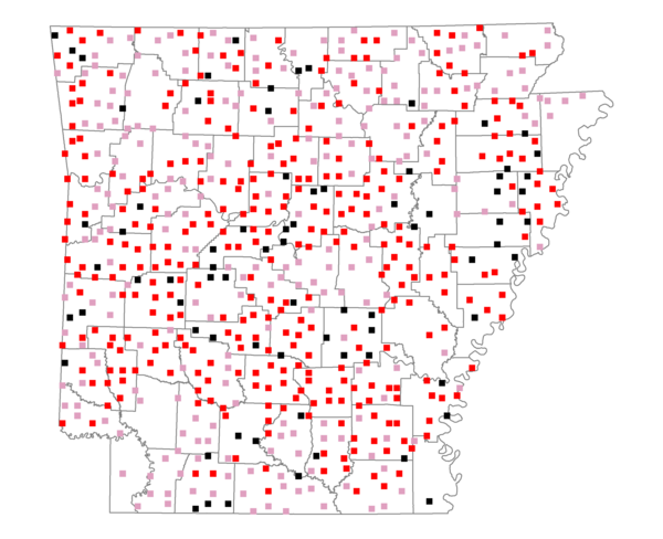
Total number of 2,500 hectare plots where this species is found: 651 ( 74.4% of plots )
| CATEGORY | Hectares, 1994 | % of Total, 1994 | Hectares, 1999 | % of Total, 1999 | Hectares, 2004 | % of Total, 2004 |
| Forest - Total (All Categories) | 1003249.9 | 55.64 | 1019103.6 | 62.60 | 1007590.2 | 61.90 |
| Ozark-Ouachita Pine-Oak Forest | 313470.9 | 17.38 | 274978.5 | 16.89 | 270250.4 | 16.60 |
| Ozark-Ouachita Dry Oak Woodland and Forest | 44856.4 | 2.49 | 33683.4 | 2.07 | 33111.4 | 2.03 |
| Central Interior Highlands Glade and Barrens | 38647.4 | 2.14 | 31032.2 | 1.91 | 30641.9 | 1.88 |
| Mesic Hardwood Forest | 1577.7 | 0.09 | 1375.5 | 0.08 | 1364.5 | 0.08 |
| Dry-Mesic Oak Forest | 231665.0 | 12.85 | 189569.2 | 11.65 | 184896.0 | 11.36 |
| West Gulf Coastal Plain Pine-Hardwood Forest | 184603.6 | 10.24 | 160121.9 | 9.84 | 149846.8 | 9.21 |
| West Gulf Coastal Plain Small Stream Forest | 713.9 | 0.04 | 514.1 | 0.03 | 490.0 | 0.03 |
| Lower Mississippi River Low Bottomland Forest | 35469.1 | 1.97 | 26885.6 | 1.65 | 26710.4 | 1.64 |
| Lower Mississippi River High Bottomland Forest | 138266.0 | 7.67 | 116031.1 | 7.13 | 113638.2 | 6.98 |
| Lower Mississippi River Bottomland Depression | 6024.3 | 0.33 | 4984.5 | 0.31 | 4769.1 | 0.29 |
| Lower Mississippi River Riparian Forest | 1329.3 | 0.07 | 475.3 | 0.03 | 554.0 | 0.03 |
| Sweetgum | 6626.4 | 0.37 | 5420.7 | 0.33 | 5257.9 | 0.32 |
| Forest - Unknown Category | 0.0 | 0.00 | 174031.6 | 10.69 | 186059.5 | 11.43 |
| Cropland | 332533.1 | 18.44 | 242461.3 | 14.89 | 237071.1 | 14.56 |
| Pastureland | 397730.5 | 22.06 | 289055.2 | 17.76 | 274559.0 | 16.87 |
| Herbaceous | 3320.0 | 0.18 | 15579.7 | 0.96 | 23933.1 | 1.47 |
| Bare/Barren | 1153.6 | 0.06 | 672.8 | 0.04 | 1325.7 | 0.08 |
| Urban | 8262.4 | 0.46 | 14146.7 | 0.87 | 38541.1 | 2.37 |
| Water | 41288.6 | 2.29 | 32885.8 | 2.02 | 30818.5 | 1.89 |
| Unknown (No Data) | 15722.6 | 0.87 | 13935.6 | 0.86 | 14002.0 | 0.86 |