Species Report
King Rail
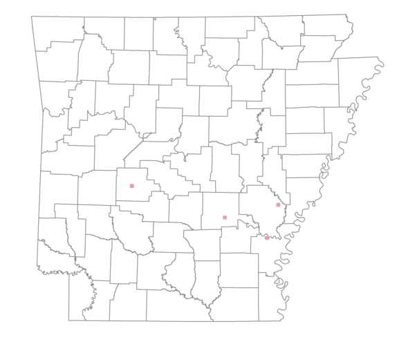
Total number of 2,500 hectare plots where this species is found: 4 ( 0.5% of plots )
| CATEGORY | Hectares, 1994 | % of Total, 1994 | Hectares, 1999 | % of Total, 1999 | Hectares, 2004 | % of Total, 2004 |
| Forest - Total (All Categories) | 3842.5 | 34.56 | 4175.0 | 41.54 | 4027.9 | 40.08 |
| Ozark-Ouachita Pine-Oak Forest | 1648.1 | 14.82 | 1473.2 | 14.66 | 1418.1 | 14.11 |
| Ozark-Ouachita Dry Oak Woodland and Forest | 0.0 | 0.00 | 0.0 | 0.00 | 0.0 | 0.00 |
| Central Interior Highlands Glade and Barrens | 0.0 | 0.00 | 0.0 | 0.00 | 0.0 | 0.00 |
| Mesic Hardwood Forest | 0.0 | 0.00 | 0.0 | 0.00 | 0.0 | 0.00 |
| Dry-Mesic Oak Forest | 237.4 | 2.14 | 211.3 | 2.10 | 209.6 | 2.09 |
| West Gulf Coastal Plain Pine-Hardwood Forest | 0.0 | 0.00 | 0.0 | 0.00 | 0.0 | 0.00 |
| West Gulf Coastal Plain Small Stream Forest | 58.2 | 0.52 | 47.4 | 0.47 | 48.4 | 0.48 |
| Lower Mississippi River Low Bottomland Forest | 402.0 | 3.62 | 298.0 | 2.97 | 287.7 | 2.86 |
| Lower Mississippi River High Bottomland Forest | 1338.0 | 12.03 | 1153.6 | 11.48 | 1113.6 | 11.08 |
| Lower Mississippi River Bottomland Depression | 16.3 | 0.15 | 10.6 | 0.11 | 9.5 | 0.09 |
| Lower Mississippi River Riparian Forest | 40.8 | 0.37 | 33.1 | 0.33 | 31.2 | 0.31 |
| Sweetgum | 101.6 | 0.91 | 85.7 | 0.85 | 69.9 | 0.70 |
| Forest - Unknown Category | 0.0 | 0.00 | 862.0 | 8.58 | 839.9 | 8.36 |
| Cropland | 5953.9 | 53.54 | 4455.2 | 44.33 | 4310.0 | 42.89 |
| Pastureland | 211.2 | 1.90 | 411.2 | 4.09 | 460.9 | 4.59 |
| Herbaceous | 47.6 | 0.43 | 67.8 | 0.67 | 101.0 | 1.01 |
| Bare/Barren | 50.8 | 0.46 | 123.9 | 1.23 | 34.3 | 0.34 |
| Urban | 85.6 | 0.77 | 136.1 | 1.35 | 411.0 | 4.09 |
| Water | 926.3 | 8.33 | 680.6 | 6.77 | 704.7 | 7.01 |
| Unknown (No Data) | 1.9 | 0.02 | 0.0 | 0.00 | 0.0 | 0.00 |