Species Report
Greater Roadrunner
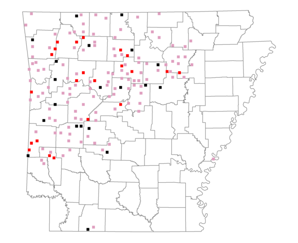
Total number of 2,500 hectare plots where this species is found: 159 ( 18.2% of plots )
| CATEGORY | Hectares, 1994 | % of Total, 1994 | Hectares, 1999 | % of Total, 1999 | Hectares, 2004 | % of Total, 2004 |
| Forest - Total (All Categories) | 256113.8 | 58.12 | 270345.2 | 68.00 | 269204.0 | 67.71 |
| Ozark-Ouachita Pine-Oak Forest | 144269.1 | 32.74 | 126157.0 | 31.73 | 123932.8 | 31.17 |
| Ozark-Ouachita Dry Oak Woodland and Forest | 13812.5 | 3.13 | 10142.0 | 2.55 | 10186.9 | 2.56 |
| Central Interior Highlands Glade and Barrens | 13266.1 | 3.01 | 10105.0 | 2.54 | 10127.3 | 2.55 |
| Mesic Hardwood Forest | 1634.0 | 0.37 | 1441.8 | 0.36 | 1437.5 | 0.36 |
| Dry-Mesic Oak Forest | 68072.1 | 15.45 | 55569.8 | 13.98 | 54600.2 | 13.73 |
| West Gulf Coastal Plain Pine-Hardwood Forest | 3329.7 | 0.76 | 2884.1 | 0.73 | 2796.8 | 0.70 |
| West Gulf Coastal Plain Small Stream Forest | 80.4 | 0.02 | 59.5 | 0.01 | 71.3 | 0.02 |
| Lower Mississippi River Low Bottomland Forest | 434.2 | 0.10 | 346.3 | 0.09 | 347.4 | 0.09 |
| Lower Mississippi River High Bottomland Forest | 8807.8 | 2.00 | 7153.6 | 1.80 | 6878.7 | 1.73 |
| Lower Mississippi River Bottomland Depression | 245.3 | 0.06 | 204.5 | 0.05 | 208.4 | 0.05 |
| Lower Mississippi River Riparian Forest | 213.8 | 0.05 | 167.1 | 0.04 | 167.4 | 0.04 |
| Sweetgum | 1949.0 | 0.44 | 1601.5 | 0.40 | 1558.9 | 0.39 |
| Forest - Unknown Category | 0.0 | 0.00 | 54512.9 | 13.71 | 56890.4 | 14.31 |
| Cropland | 21361.0 | 4.85 | 3732.0 | 0.94 | 4456.0 | 1.12 |
| Pastureland | 143642.4 | 32.60 | 106033.0 | 26.67 | 99433.5 | 25.01 |
| Herbaceous | 28.4 | 0.01 | 783.5 | 0.20 | 2475.7 | 0.62 |
| Bare/Barren | 0.0 | 0.00 | 109.7 | 0.03 | 127.9 | 0.03 |
| Urban | 1405.4 | 0.32 | 1449.6 | 0.36 | 6983.2 | 1.76 |
| Water | 9610.1 | 2.18 | 7508.0 | 1.89 | 7242.0 | 1.82 |
| Unknown (No Data) | 8515.2 | 1.93 | 7617.6 | 1.92 | 7656.1 | 1.93 |