Species Report
Great-tailed Grackle
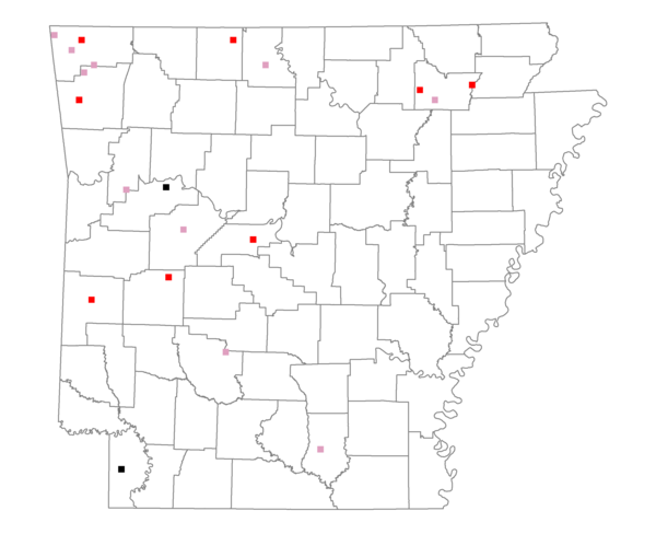
Total number of 2,500 hectare plots where this species is found: 20 ( 2.3% of plots )
| CATEGORY | Hectares, 1994 | % of Total, 1994 | Hectares, 1999 | % of Total, 1999 | Hectares, 2004 | % of Total, 2004 |
| Forest - Total (All Categories) | 23534.7 | 42.45 | 24252.7 | 48.44 | 24317.9 | 48.57 |
| Ozark-Ouachita Pine-Oak Forest | 6822.9 | 12.31 | 5877.8 | 11.74 | 5837.9 | 11.66 |
| Ozark-Ouachita Dry Oak Woodland and Forest | 2147.1 | 3.87 | 1496.1 | 2.99 | 1467.8 | 2.93 |
| Central Interior Highlands Glade and Barrens | 2519.2 | 4.54 | 1745.0 | 3.49 | 1781.5 | 3.56 |
| Mesic Hardwood Forest | 0.0 | 0.00 | 0.0 | 0.00 | 0.0 | 0.00 |
| Dry-Mesic Oak Forest | 5766.8 | 10.40 | 4206.1 | 8.40 | 4117.1 | 8.22 |
| West Gulf Coastal Plain Pine-Hardwood Forest | 2912.2 | 5.25 | 2282.7 | 4.56 | 2182.6 | 4.36 |
| West Gulf Coastal Plain Small Stream Forest | 0.0 | 0.00 | 0.0 | 0.00 | 0.0 | 0.00 |
| Lower Mississippi River Low Bottomland Forest | 207.8 | 0.37 | 140.2 | 0.28 | 114.2 | 0.23 |
| Lower Mississippi River High Bottomland Forest | 2860.6 | 5.16 | 2337.7 | 4.67 | 2283.4 | 4.56 |
| Lower Mississippi River Bottomland Depression | 20.8 | 0.04 | 17.0 | 0.03 | 16.9 | 0.03 |
| Lower Mississippi River Riparian Forest | 0.0 | 0.00 | 0.0 | 0.00 | 0.0 | 0.00 |
| Sweetgum | 277.4 | 0.50 | 230.7 | 0.46 | 225.5 | 0.45 |
| Forest - Unknown Category | 0.0 | 0.00 | 5919.5 | 11.82 | 6291.0 | 12.57 |
| Cropland | 7283.5 | 13.14 | 3656.3 | 7.30 | 3749.7 | 7.49 |
| Pastureland | 22887.8 | 41.28 | 20458.4 | 40.86 | 19361.2 | 38.67 |
| Herbaceous | 5.9 | 0.01 | 460.4 | 0.92 | 386.5 | 0.77 |
| Bare/Barren | 180.3 | 0.33 | 4.6 | 0.01 | 44.4 | 0.09 |
| Urban | 494.4 | 0.89 | 487.2 | 0.97 | 1518.0 | 3.03 |
| Water | 1026.5 | 1.85 | 744.0 | 1.49 | 685.9 | 1.37 |
| Unknown (No Data) | 27.6 | 0.05 | 0.0 | 0.00 | 0.0 | 0.00 |