Species Report
Gray Catbird
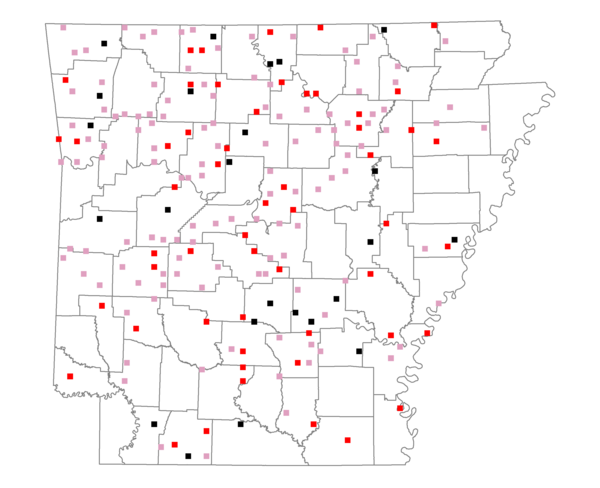
Total number of 2,500 hectare plots where this species is found: 203 ( 23.2% of plots )
| CATEGORY | Hectares, 1994 | % of Total, 1994 | Hectares, 1999 | % of Total, 1999 | Hectares, 2004 | % of Total, 2004 |
| Forest - Total (All Categories) | 350288.8 | 62.30 | 348577.1 | 68.67 | 344565.2 | 67.88 |
| Ozark-Ouachita Pine-Oak Forest | 126920.0 | 22.57 | 111132.7 | 21.89 | 109154.1 | 21.50 |
| Ozark-Ouachita Dry Oak Woodland and Forest | 18568.4 | 3.30 | 14460.5 | 2.85 | 14220.6 | 2.80 |
| Central Interior Highlands Glade and Barrens | 19625.9 | 3.49 | 15704.5 | 3.09 | 15545.8 | 3.06 |
| Mesic Hardwood Forest | 1033.7 | 0.18 | 893.0 | 0.18 | 896.7 | 0.18 |
| Dry-Mesic Oak Forest | 98161.9 | 17.46 | 82043.0 | 16.16 | 80578.1 | 15.87 |
| West Gulf Coastal Plain Pine-Hardwood Forest | 37175.4 | 6.61 | 32283.9 | 6.36 | 30372.1 | 5.98 |
| West Gulf Coastal Plain Small Stream Forest | 332.5 | 0.06 | 256.8 | 0.05 | 273.0 | 0.05 |
| Lower Mississippi River Low Bottomland Forest | 7521.5 | 1.34 | 5696.6 | 1.12 | 5719.5 | 1.13 |
| Lower Mississippi River High Bottomland Forest | 37318.4 | 6.64 | 31410.2 | 6.19 | 30880.5 | 6.08 |
| Lower Mississippi River Bottomland Depression | 1291.6 | 0.23 | 1054.1 | 0.21 | 1018.8 | 0.20 |
| Lower Mississippi River Riparian Forest | 266.0 | 0.05 | 144.7 | 0.03 | 152.1 | 0.03 |
| Sweetgum | 2073.4 | 0.37 | 1669.3 | 0.33 | 1616.8 | 0.32 |
| Forest - Unknown Category | 0.0 | 0.00 | 51827.9 | 10.21 | 54136.9 | 10.66 |
| Cropland | 55743.9 | 9.91 | 39254.8 | 7.73 | 38420.0 | 7.57 |
| Pastureland | 126561.1 | 22.51 | 86897.7 | 17.12 | 82645.1 | 16.28 |
| Herbaceous | 466.0 | 0.08 | 3501.9 | 0.69 | 4160.9 | 0.82 |
| Bare/Barren | 199.6 | 0.04 | 296.7 | 0.06 | 610.1 | 0.12 |
| Urban | 3327.9 | 0.59 | 7556.3 | 1.49 | 16696.5 | 3.29 |
| Water | 18882.4 | 3.36 | 15491.7 | 3.05 | 14462.5 | 2.85 |
| Unknown (No Data) | 6814.1 | 1.21 | 6037.1 | 1.19 | 6053.0 | 1.19 |