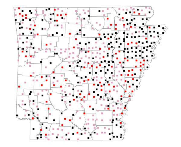
Species Report
Common Grackle

Total number of 2,500 hectare plots where this species is found: 559 ( 63.9% of plots )
| CATEGORY | Hectares, 1994 | % of Total, 1994 | Hectares, 1999 | % of Total, 1999 | Hectares, 2004 | % of Total, 2004 |
| Forest - Total (All Categories) | 685796.9 | 44.29 | 687368.6 | 49.18 | 685332.9 | 49.04 |
| Ozark-Ouachita Pine-Oak Forest | 153194.7 | 9.89 | 131822.8 | 9.43 | 128960.9 | 9.23 |
| Ozark-Ouachita Dry Oak Woodland and Forest | 33680.9 | 2.18 | 24769.6 | 1.77 | 24304.7 | 1.74 |
| Central Interior Highlands Glade and Barrens | 25353.1 | 1.64 | 20005.2 | 1.43 | 19812.8 | 1.42 |
| Mesic Hardwood Forest | 1112.3 | 0.07 | 978.0 | 0.07 | 974.7 | 0.07 |
| Dry-Mesic Oak Forest | 175490.2 | 11.33 | 140482.9 | 10.05 | 136837.8 | 9.79 |
| West Gulf Coastal Plain Pine-Hardwood Forest | 114870.7 | 7.42 | 99124.6 | 7.09 | 92967.5 | 6.65 |
| West Gulf Coastal Plain Small Stream Forest | 1323.4 | 0.09 | 775.1 | 0.06 | 761.1 | 0.05 |
| Lower Mississippi River Low Bottomland Forest | 49292.5 | 3.18 | 36682.2 | 2.62 | 36825.2 | 2.63 |
| Lower Mississippi River High Bottomland Forest | 119571.2 | 7.72 | 98339.1 | 7.04 | 96639.2 | 6.91 |
| Lower Mississippi River Bottomland Depression | 5439.7 | 0.35 | 4301.2 | 0.31 | 4219.5 | 0.30 |
| Lower Mississippi River Riparian Forest | 1636.8 | 0.11 | 456.0 | 0.03 | 543.8 | 0.04 |
| Sweetgum | 4831.4 | 0.31 | 3838.0 | 0.27 | 3710.0 | 0.27 |
| Forest - Unknown Category | 0.0 | 0.00 | 125793.8 | 9.00 | 138775.6 | 9.93 |
| Cropland | 477996.5 | 30.87 | 378175.4 | 27.06 | 369925.8 | 26.47 |
| Pastureland | 294831.8 | 19.04 | 237627.8 | 17.00 | 222147.7 | 15.90 |
| Herbaceous | 4090.3 | 0.26 | 13592.2 | 0.97 | 18325.6 | 1.31 |
| Bare/Barren | 1775.3 | 0.11 | 791.2 | 0.06 | 1952.7 | 0.14 |
| Urban | 7328.0 | 0.47 | 16127.1 | 1.15 | 39993.8 | 2.86 |
| Water | 55285.4 | 3.57 | 44952.7 | 3.22 | 40923.4 | 2.93 |
| Unknown (No Data) | 21381.5 | 1.38 | 18945.8 | 1.36 | 18979.0 | 1.36 |