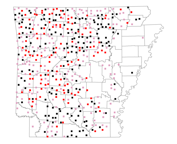
Species Report
Chipping Sparrow

Total number of 2,500 hectare plots where this species is found: 467 ( 53.4% of plots )
| CATEGORY | Hectares, 1994 | % of Total, 1994 | Hectares, 1999 | % of Total, 1999 | Hectares, 2004 | % of Total, 2004 |
| Forest - Total (All Categories) | 814530.6 | 62.95 | 827852.2 | 70.88 | 817578.0 | 70.00 |
| Ozark-Ouachita Pine-Oak Forest | 275657.4 | 21.30 | 242067.4 | 20.73 | 237773.5 | 20.36 |
| Ozark-Ouachita Dry Oak Woodland and Forest | 50921.1 | 3.94 | 38857.8 | 3.33 | 38282.8 | 3.28 |
| Central Interior Highlands Glade and Barrens | 45191.0 | 3.49 | 36477.5 | 3.12 | 36160.3 | 3.10 |
| Mesic Hardwood Forest | 2173.6 | 0.17 | 1903.3 | 0.16 | 1890.8 | 0.16 |
| Dry-Mesic Oak Forest | 216176.6 | 16.71 | 181142.4 | 15.51 | 177658.0 | 15.21 |
| West Gulf Coastal Plain Pine-Hardwood Forest | 124381.4 | 9.61 | 108054.6 | 9.25 | 102852.0 | 8.81 |
| West Gulf Coastal Plain Small Stream Forest | 339.9 | 0.03 | 270.2 | 0.02 | 277.6 | 0.02 |
| Lower Mississippi River Low Bottomland Forest | 13545.4 | 1.05 | 10980.1 | 0.94 | 10625.4 | 0.91 |
| Lower Mississippi River High Bottomland Forest | 77064.8 | 5.96 | 64769.0 | 5.55 | 63420.7 | 5.43 |
| Lower Mississippi River Bottomland Depression | 3563.2 | 0.28 | 2966.1 | 0.25 | 2884.0 | 0.25 |
| Lower Mississippi River Riparian Forest | 969.8 | 0.07 | 369.6 | 0.03 | 397.2 | 0.03 |
| Sweetgum | 4546.4 | 0.35 | 3758.4 | 0.32 | 3613.1 | 0.31 |
| Forest - Unknown Category | 0.0 | 0.00 | 136235.9 | 11.67 | 141742.7 | 12.14 |
| Cropland | 85972.5 | 6.64 | 46432.2 | 3.98 | 46818.2 | 4.01 |
| Pastureland | 346141.1 | 26.75 | 244047.5 | 20.90 | 230499.0 | 19.74 |
| Herbaceous | 654.3 | 0.05 | 7576.5 | 0.65 | 13059.8 | 1.12 |
| Bare/Barren | 165.5 | 0.01 | 145.6 | 0.01 | 484.3 | 0.04 |
| Urban | 6079.4 | 0.47 | 8468.0 | 0.73 | 27468.7 | 2.35 |
| Water | 28785.1 | 2.22 | 22949.6 | 1.97 | 21513.3 | 1.84 |
| Unknown (No Data) | 11664.6 | 0.90 | 10418.0 | 0.89 | 10468.4 | 0.90 |