Species Report
Cattle Egret
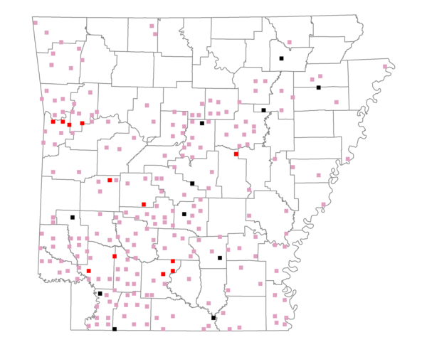
Total number of 2,500 hectare plots where this species is found: 240 ( 27.4% of plots )
| CATEGORY | Hectares, 1994 | % of Total, 1994 | Hectares, 1999 | % of Total, 1999 | Hectares, 2004 | % of Total, 2004 |
| Forest - Total (All Categories) | 360667.5 | 54.25 | 380821.6 | 63.47 | 380338.4 | 63.39 |
| Ozark-Ouachita Pine-Oak Forest | 80052.1 | 12.04 | 69646.3 | 11.61 | 68287.2 | 11.38 |
| Ozark-Ouachita Dry Oak Woodland and Forest | 5317.2 | 0.80 | 3836.9 | 0.64 | 3846.9 | 0.64 |
| Central Interior Highlands Glade and Barrens | 4578.7 | 0.69 | 3505.8 | 0.58 | 3519.2 | 0.59 |
| Mesic Hardwood Forest | 132.2 | 0.02 | 113.5 | 0.02 | 103.4 | 0.02 |
| Dry-Mesic Oak Forest | 64469.9 | 9.70 | 52222.2 | 8.70 | 51036.6 | 8.51 |
| West Gulf Coastal Plain Pine-Hardwood Forest | 103294.5 | 15.54 | 89646.8 | 14.94 | 85302.3 | 14.22 |
| West Gulf Coastal Plain Small Stream Forest | 299.4 | 0.05 | 218.9 | 0.04 | 222.0 | 0.04 |
| Lower Mississippi River Low Bottomland Forest | 9775.4 | 1.47 | 7521.0 | 1.25 | 7426.7 | 1.24 |
| Lower Mississippi River High Bottomland Forest | 85820.8 | 12.91 | 72074.0 | 12.01 | 70632.9 | 11.77 |
| Lower Mississippi River Bottomland Depression | 3586.1 | 0.54 | 3020.8 | 0.50 | 2950.9 | 0.49 |
| Lower Mississippi River Riparian Forest | 623.6 | 0.09 | 249.4 | 0.04 | 259.9 | 0.04 |
| Sweetgum | 2717.6 | 0.41 | 2127.9 | 0.35 | 2018.1 | 0.34 |
| Forest - Unknown Category | 0.0 | 0.00 | 76637.9 | 12.77 | 84732.1 | 14.12 |
| Cropland | 98103.8 | 14.76 | 53830.2 | 8.97 | 51375.5 | 8.56 |
| Pastureland | 170742.1 | 25.68 | 126635.5 | 21.10 | 116449.0 | 19.41 |
| Herbaceous | 1634.1 | 0.25 | 8055.7 | 1.34 | 11324.2 | 1.89 |
| Bare/Barren | 495.3 | 0.07 | 387.7 | 0.06 | 666.4 | 0.11 |
| Urban | 3368.6 | 0.51 | 7313.4 | 1.22 | 17476.5 | 2.91 |
| Water | 23841.9 | 3.59 | 17632.8 | 2.94 | 17024.6 | 2.84 |
| Unknown (No Data) | 6011.5 | 0.90 | 5358.3 | 0.89 | 5380.4 | 0.90 |