Species Report
Blue-winged Teal
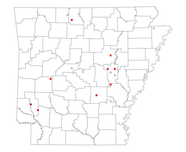
Total number of 2,500 hectare plots where this species is found: 14 ( 1.6% of plots )
| CATEGORY | Hectares, 1994 | % of Total, 1994 | Hectares, 1999 | % of Total, 1999 | Hectares, 2004 | % of Total, 2004 |
| Forest - Total (All Categories) | 16511.5 | 42.55 | 17226.0 | 49.20 | 18277.8 | 52.21 |
| Ozark-Ouachita Pine-Oak Forest | 3443.1 | 8.87 | 3019.0 | 8.62 | 2981.6 | 8.52 |
| Ozark-Ouachita Dry Oak Woodland and Forest | 1045.4 | 2.69 | 713.6 | 2.04 | 731.8 | 2.09 |
| Central Interior Highlands Glade and Barrens | 1367.8 | 3.52 | 1160.8 | 3.32 | 1155.3 | 3.30 |
| Mesic Hardwood Forest | 0.0 | 0.00 | 0.0 | 0.00 | 0.0 | 0.00 |
| Dry-Mesic Oak Forest | 1714.6 | 4.42 | 1495.0 | 4.27 | 1421.0 | 4.06 |
| West Gulf Coastal Plain Pine-Hardwood Forest | 1882.9 | 4.85 | 1498.8 | 4.28 | 1509.3 | 4.31 |
| West Gulf Coastal Plain Small Stream Forest | 0.0 | 0.00 | 0.0 | 0.00 | 0.0 | 0.00 |
| Lower Mississippi River Low Bottomland Forest | 1061.5 | 2.74 | 733.6 | 2.10 | 712.0 | 2.03 |
| Lower Mississippi River High Bottomland Forest | 5252.3 | 13.53 | 4445.2 | 12.70 | 4397.5 | 12.56 |
| Lower Mississippi River Bottomland Depression | 242.0 | 0.62 | 155.1 | 0.44 | 150.3 | 0.43 |
| Lower Mississippi River Riparian Forest | 85.9 | 0.22 | 43.4 | 0.12 | 60.0 | 0.17 |
| Sweetgum | 416.0 | 1.07 | 351.1 | 1.00 | 348.0 | 0.99 |
| Forest - Unknown Category | 0.0 | 0.00 | 3610.5 | 10.31 | 4810.9 | 13.74 |
| Cropland | 14258.7 | 36.74 | 9174.1 | 26.20 | 8478.1 | 24.22 |
| Pastureland | 5323.3 | 13.72 | 5766.2 | 16.47 | 5394.4 | 15.41 |
| Herbaceous | 61.0 | 0.16 | 173.5 | 0.50 | 237.9 | 0.68 |
| Bare/Barren | 0.0 | 0.00 | 18.0 | 0.05 | 40.8 | 0.12 |
| Urban | 107.0 | 0.28 | 324.8 | 0.93 | 710.0 | 2.03 |
| Water | 2547.3 | 6.56 | 2327.6 | 6.65 | 1871.2 | 5.34 |
| Unknown (No Data) | 0.0 | 0.00 | 0.0 | 0.00 | 0.0 | 0.00 |