Species Report
Black-necked Stilt
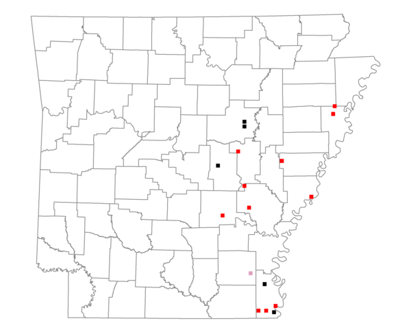
Total number of 2,500 hectare plots where this species is found: 17 ( 1.9% of plots )
| CATEGORY | Hectares, 1994 | % of Total, 1994 | Hectares, 1999 | % of Total, 1999 | Hectares, 2004 | % of Total, 2004 |
| Forest - Total (All Categories) | 6163.6 | 13.08 | 6985.5 | 16.42 | 9152.7 | 21.52 |
| Ozark-Ouachita Pine-Oak Forest | 22.0 | 0.05 | 18.2 | 0.04 | 18.3 | 0.04 |
| Ozark-Ouachita Dry Oak Woodland and Forest | 0.0 | 0.00 | 0.0 | 0.00 | 0.0 | 0.00 |
| Central Interior Highlands Glade and Barrens | 0.0 | 0.00 | 0.0 | 0.00 | 0.0 | 0.00 |
| Mesic Hardwood Forest | 0.0 | 0.00 | 0.0 | 0.00 | 0.0 | 0.00 |
| Dry-Mesic Oak Forest | 323.4 | 0.69 | 261.7 | 0.62 | 261.1 | 0.61 |
| West Gulf Coastal Plain Pine-Hardwood Forest | 983.5 | 2.09 | 778.7 | 1.83 | 809.4 | 1.90 |
| West Gulf Coastal Plain Small Stream Forest | 50.2 | 0.11 | 33.5 | 0.08 | 34.0 | 0.08 |
| Lower Mississippi River Low Bottomland Forest | 1617.8 | 3.43 | 1023.3 | 2.41 | 1076.0 | 2.53 |
| Lower Mississippi River High Bottomland Forest | 2744.8 | 5.83 | 2161.2 | 5.08 | 2145.2 | 5.04 |
| Lower Mississippi River Bottomland Depression | 87.8 | 0.19 | 51.7 | 0.12 | 53.3 | 0.13 |
| Lower Mississippi River Riparian Forest | 199.4 | 0.42 | 41.8 | 0.10 | 45.4 | 0.11 |
| Sweetgum | 134.8 | 0.29 | 109.7 | 0.26 | 114.2 | 0.27 |
| Forest - Unknown Category | 0.0 | 0.00 | 2505.8 | 5.89 | 4596.0 | 10.81 |
| Cropland | 35400.5 | 75.15 | 27264.3 | 64.11 | 25400.2 | 59.72 |
| Pastureland | 181.9 | 0.39 | 2003.3 | 4.71 | 1838.1 | 4.32 |
| Herbaceous | 208.4 | 0.44 | 1879.6 | 4.42 | 1918.4 | 4.51 |
| Bare/Barren | 142.6 | 0.30 | 32.5 | 0.08 | 46.6 | 0.11 |
| Urban | 6.2 | 0.01 | 66.6 | 0.16 | 448.3 | 1.05 |
| Water | 4234.2 | 8.99 | 3606.9 | 8.48 | 3034.2 | 7.13 |
| Unknown (No Data) | 771.7 | 1.64 | 691.1 | 1.62 | 691.4 | 1.63 |