Species Report
Red-headed Woodpecker
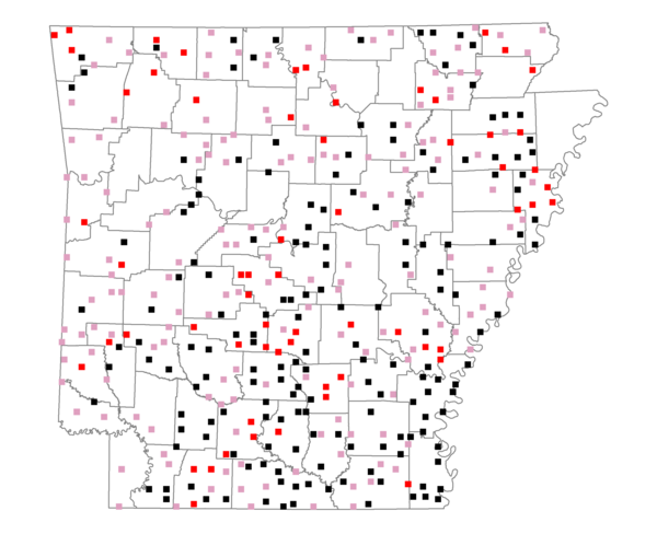
Total number of 2,500 hectare plots where this species is found: 396 ( 45.3% of plots )
| CATEGORY | Hectares, 1994 | % of Total, 1994 | Hectares, 1999 | % of Total, 1999 | Hectares, 2004 | % of Total, 2004 |
| Forest - Total (All Categories) | 615365.2 | 56.09 | 615153.6 | 62.13 | 603568.3 | 60.96 |
| Ozark-Ouachita Pine-Oak Forest | 151803.7 | 13.84 | 133306.3 | 13.46 | 130145.5 | 13.14 |
| Ozark-Ouachita Dry Oak Woodland and Forest | 16879.6 | 1.54 | 12478.7 | 1.26 | 12263.0 | 1.24 |
| Central Interior Highlands Glade and Barrens | 17781.3 | 1.62 | 13934.4 | 1.41 | 13865.6 | 1.40 |
| Mesic Hardwood Forest | 849.8 | 0.08 | 733.1 | 0.07 | 735.6 | 0.07 |
| Dry-Mesic Oak Forest | 125398.8 | 11.43 | 103138.5 | 10.42 | 100449.3 | 10.14 |
| West Gulf Coastal Plain Pine-Hardwood Forest | 150755.7 | 13.74 | 131037.9 | 13.23 | 122044.0 | 12.33 |
| West Gulf Coastal Plain Small Stream Forest | 561.7 | 0.05 | 392.9 | 0.04 | 411.2 | 0.04 |
| Lower Mississippi River Low Bottomland Forest | 34011.0 | 3.10 | 25723.6 | 2.60 | 25816.1 | 2.61 |
| Lower Mississippi River High Bottomland Forest | 107451.2 | 9.79 | 91219.8 | 9.21 | 89584.4 | 9.05 |
| Lower Mississippi River Bottomland Depression | 6173.2 | 0.56 | 5152.5 | 0.52 | 4991.2 | 0.50 |
| Lower Mississippi River Riparian Forest | 1020.3 | 0.09 | 307.7 | 0.03 | 338.5 | 0.03 |
| Sweetgum | 2678.9 | 0.24 | 2248.7 | 0.23 | 2179.8 | 0.22 |
| Forest - Unknown Category | 0.0 | 0.00 | 95479.5 | 9.64 | 100744.0 | 10.17 |
| Cropland | 235947.3 | 21.50 | 182819.2 | 18.46 | 178132.0 | 17.99 |
| Pastureland | 181592.0 | 16.55 | 123812.7 | 12.50 | 121700.1 | 12.29 |
| Herbaceous | 2369.1 | 0.22 | 12947.2 | 1.31 | 19722.4 | 1.99 |
| Bare/Barren | 1257.8 | 0.11 | 822.1 | 0.08 | 1247.0 | 0.13 |
| Urban | 4578.8 | 0.42 | 8596.9 | 0.87 | 21829.9 | 2.20 |
| Water | 37633.2 | 3.43 | 29507.6 | 2.98 | 27398.6 | 2.77 |
| Unknown (No Data) | 18451.0 | 1.68 | 16520.9 | 1.67 | 16581.9 | 1.67 |