Species Report
Louisiana Waterthrush
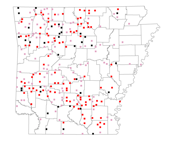
Total number of 2,500 hectare plots where this species is found: 250 ( 28.6% of plots )
| CATEGORY | Hectares, 1994 | % of Total, 1994 | Hectares, 1999 | % of Total, 1999 | Hectares, 2004 | % of Total, 2004 |
| Forest - Total (All Categories) | 486467.9 | 70.21 | 487258.6 | 77.94 | 481512.4 | 77.02 |
| Ozark-Ouachita Pine-Oak Forest | 164435.9 | 23.73 | 145482.5 | 23.27 | 143509.1 | 22.96 |
| Ozark-Ouachita Dry Oak Woodland and Forest | 24695.4 | 3.56 | 19708.8 | 3.15 | 19479.4 | 3.12 |
| Central Interior Highlands Glade and Barrens | 25067.5 | 3.62 | 20493.7 | 3.28 | 20373.3 | 3.26 |
| Mesic Hardwood Forest | 1370.1 | 0.20 | 1195.8 | 0.19 | 1188.6 | 0.19 |
| Dry-Mesic Oak Forest | 120670.7 | 17.42 | 103195.0 | 16.51 | 101756.2 | 16.28 |
| West Gulf Coastal Plain Pine-Hardwood Forest | 82899.2 | 11.96 | 72431.1 | 11.59 | 67816.1 | 10.85 |
| West Gulf Coastal Plain Small Stream Forest | 245.3 | 0.04 | 193.1 | 0.03 | 204.3 | 0.03 |
| Lower Mississippi River Low Bottomland Forest | 8252.7 | 1.19 | 6700.8 | 1.07 | 6477.2 | 1.04 |
| Lower Mississippi River High Bottomland Forest | 54972.3 | 7.93 | 47342.7 | 7.57 | 46351.5 | 7.41 |
| Lower Mississippi River Bottomland Depression | 1464.6 | 0.21 | 1183.0 | 0.19 | 1170.1 | 0.19 |
| Lower Mississippi River Riparian Forest | 474.4 | 0.07 | 271.4 | 0.04 | 293.1 | 0.05 |
| Sweetgum | 1919.8 | 0.28 | 1678.9 | 0.27 | 1655.5 | 0.26 |
| Forest - Unknown Category | 0.0 | 0.00 | 67381.7 | 10.78 | 71238.0 | 11.40 |
| Cropland | 37968.1 | 5.48 | 23969.4 | 3.83 | 24021.3 | 3.84 |
| Pastureland | 145849.1 | 21.05 | 90811.4 | 14.53 | 86510.3 | 13.84 |
| Herbaceous | 369.4 | 0.05 | 4978.2 | 0.80 | 7531.9 | 1.20 |
| Bare/Barren | 83.3 | 0.01 | 76.8 | 0.01 | 326.3 | 0.05 |
| Urban | 1273.7 | 0.18 | 2888.2 | 0.46 | 10625.8 | 1.70 |
| Water | 17984.2 | 2.60 | 12590.0 | 2.01 | 12028.7 | 1.92 |
| Unknown (No Data) | 2874.4 | 0.41 | 2565.8 | 0.41 | 2581.7 | 0.41 |